 vesseltracker.com
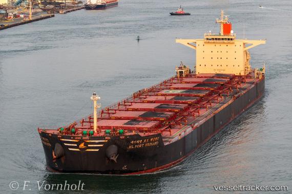
Vessel HL PORT HEDLAND IMO: 9454527, MMSI: 440194000 Bulk Carrier
Live AIS position:
UTC. Near Pohang),
updated 2025-09-17 02:43:50 UTC.
Find the position of the vessel HL PORT HEDLAND on the map. The latter are known coordinates and path.
marine traffic ship tracker show on live map
The current position of vessel HL PORT HEDLAND is 36.02368 lat / 129.40321 lng. Updated: 2025-09-17 02:43:50 UTCCurrently sailing under the flag of Korea (Republic of)
HL PORT HEDLAND built in 2010 year
Deadweight:
179283 tDetails:
Last coordinates of the vessel:
2025-09-17 02:43:50 UTC, 36.02368, 129.40321, course: 215, speed: 0